Station Hintereis
Description
- Latitude:
- 46.798896
- Longitude:
- 10.760373
- Altitude:
- 3031 m a.s.l.
Weather station at Station Hintereis (~30 m north of the hut)
Station setup
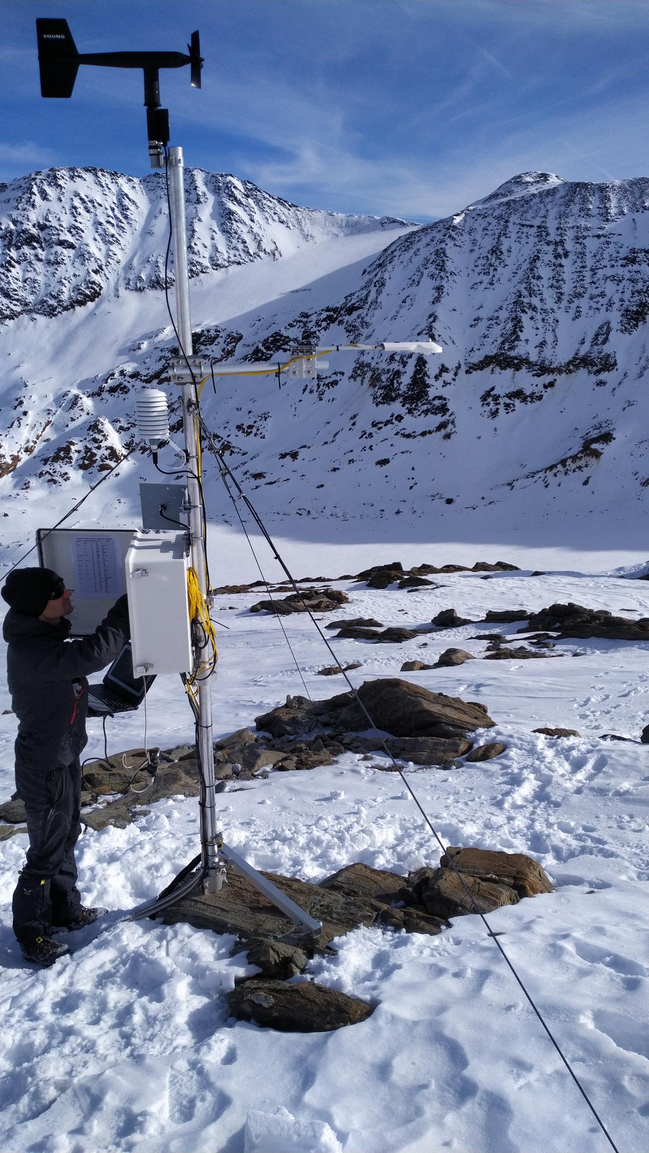
- Figure 1: Current weather station 20.11.2020
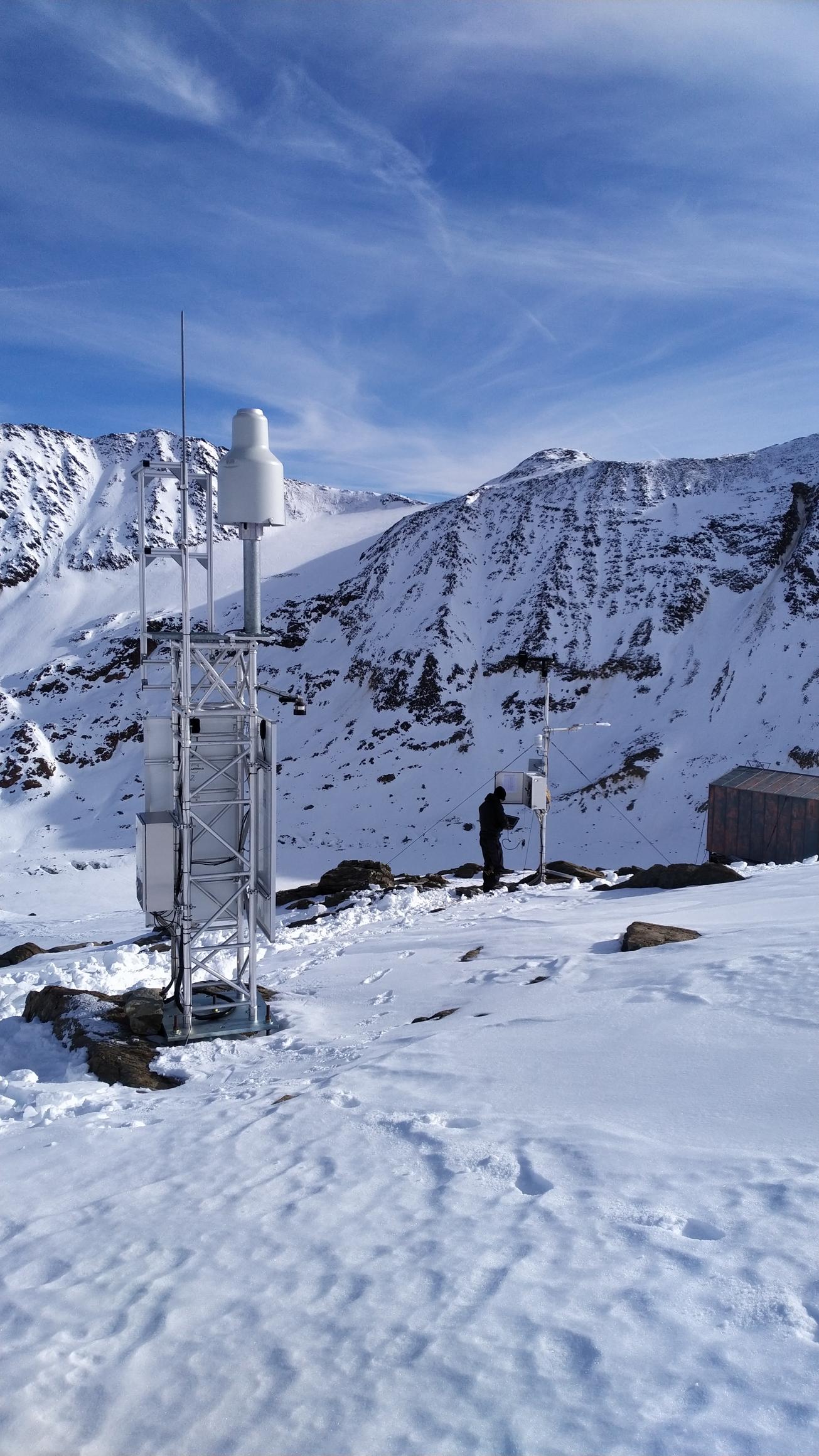
- Figure 2: Current weather station with pluviometer 20.11.2020
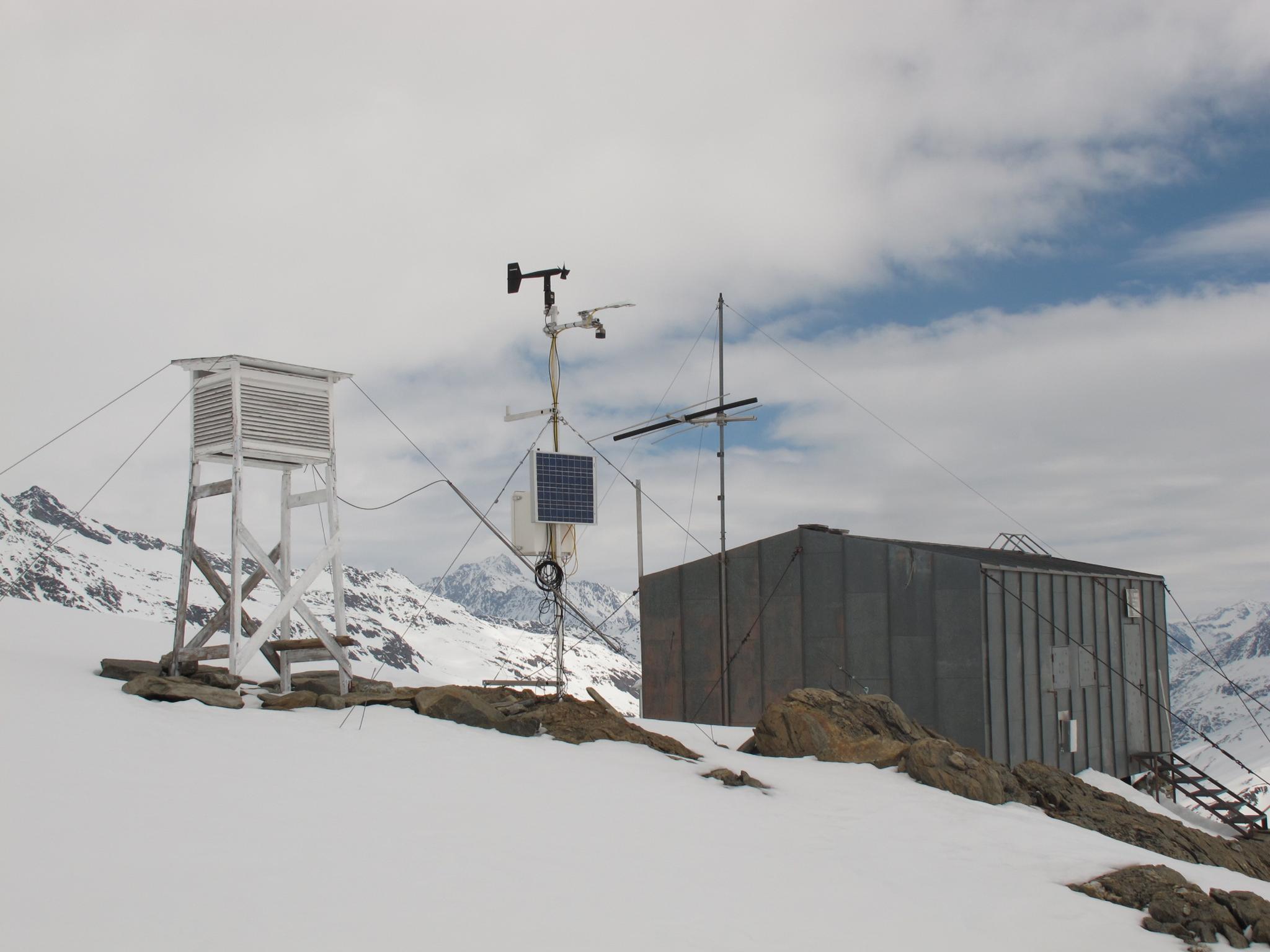
- Figure 3: Old weather station 16.04.2013

Figure 1: Current weather station 20.11.2020

Figure 2: Current weather station with pluviometer 20.11.2020

Figure 3: Old weather station 16.04.2013
Current Station Equipment (since 01.10.2020)
- Logger:
- Campbell Scientific CR3000
- Air Temperature and air humidity:
- Campbell Scientific EE181: Temp, RH unventilated in Met20 unventilated radiation shield; 2.10 m above ground. Before 01.10.2020: Vaisala HMP45c in Stevenson hut; 2 m above ground
- Soil/rock temperature:
- Three Cambpell Scientific 107 thermistors in depth of 10 cm (TC1, in 5 mm rock crack), 15 cm (TC2, underneath 70x70 cm boulder) and 20 cm (TC3, 10 cm soil/sand and 10 cm gravel). Available since 15.09.2021.
- Radiation:
- Kipp&Zonen CNR4: four component radiation measurements LWin, LWout, SWin, SWout
- Wind sensor:
- Young 05103-45 Alpine: wind speed and direction; 3.30 m above ground
- Pressure:
- Setra278 CS100: atmospheric air pressure
- Distance to surface (snow depth)
- Campbell Scientific SR50; mounted at precipitation mast; distance to snowfree ground: 2.20 m (unknown for installation before 20.11.2020)
- Solid particle flux (wind drifted snow):
- ISAW FlowCapt FC4
- Preciptiation (separate mast):
- Ott Pluvio2L
Station History
- 07th October 2010: Installation of the station ~10 m west of the hut. Air temperature and humidity probe in Stevenson Screen. (Lat: 46.798613; Lon: 10.760417; 3026 m)
- 17th August 2017: Pluviometer installed at current location. Lots of data gaps until October 2020.
- 11th November 2020: Station at current location (~35 m in distance from old location); instruments renewed/replaced
- 14th September 2021: Soil temperature probes burried (exposed to atmosphere before) and FlowCapt Sensor mounted.
Data Quality notes
- Quality issues with soil temperatures from June 2019 (exposed to atmosphere) until 15.09.2021 (newly installed)
- No quality value measured for SR50 snow depth before 04.03.2022
- Only for dataset PANGAEA: Apply atmospheric pressure correction for values measured before 20.02.2020 13:30 due to wrong offsets and multipliers in logger program
- P_corr = P*(0.2/0.24)+((-0.2/0.24*500)+600). Corrected atmospheric pressure values should be around 700 hPa
- Hygrometer broken form 17.08.2023 - 04.04.2025. Humidity values corrupt.
Datasets
- RAW
- Uncorrected raw data as it is transfered from the logger, no quality checks employed.
- PRECIPITATION
- Uncorrected raw precipitaion data as it is transfered from the logger, no quality checks employed. Refer to manual https://www.ott.com/download/operating-instructions-precipitation-gauge-ott-pluvio2-l-1/
- SNOWDRIFT
- Uncorrected raw data of wind drifted snow as it is transfered from the logger, no quality checks employed.
- UNTIL2020
- Quality controlled and corrected data 07th October 2010 - 01st October 2020 from old AWS (Figure 3). Replacing and extending uncorrected data set PANGAEA.
- PANGAEA
- Uncorrected raw data sets 2010-2012
