Im Hinteren Eis
Description
- Latitude:
- 46.795761
- Longitude:
- 10.783409
- Altitude:
- 3264 m a.s.l.
Station setup
- Figure 1: Site overview looking south.
- Figure 2: Mast instrumentation.
- Figure 3: Mast and precipitation gauge.
- Figure 4: Site overview looking north to Hintereisferner.
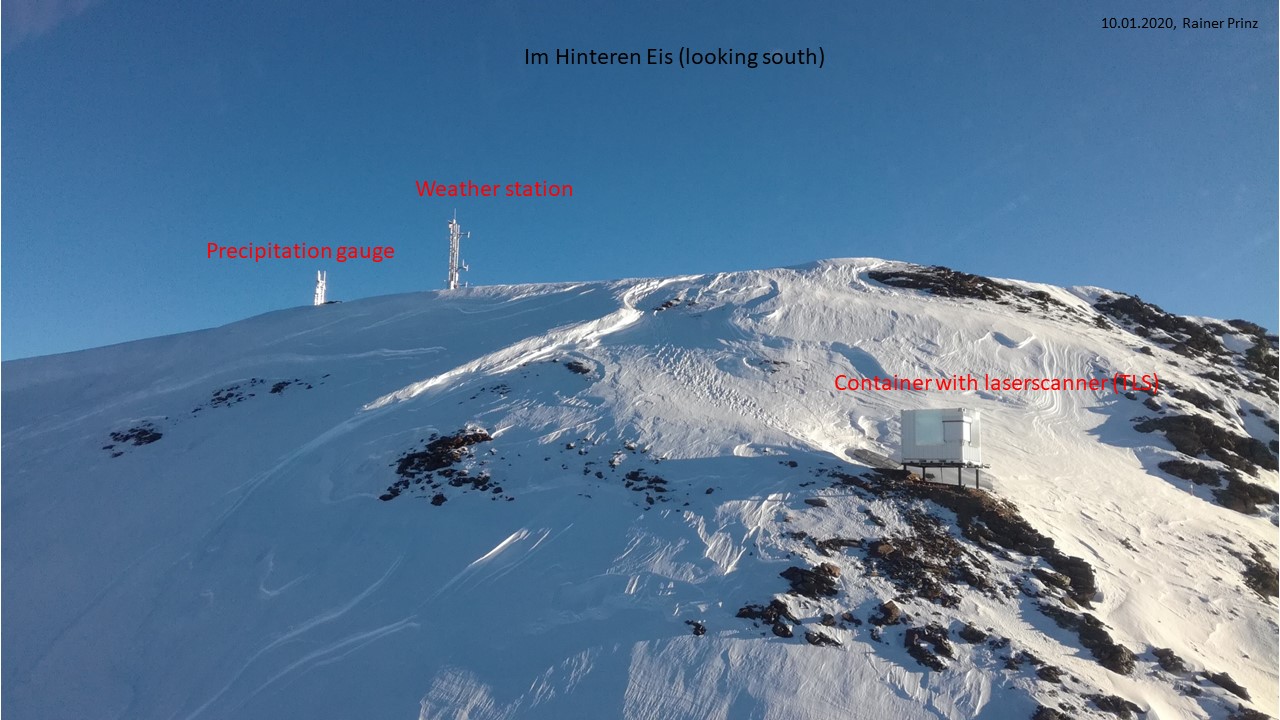
Figure 1: Site overview looking south.
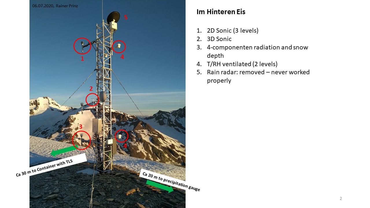
Figure 2: Mast instrumentation.
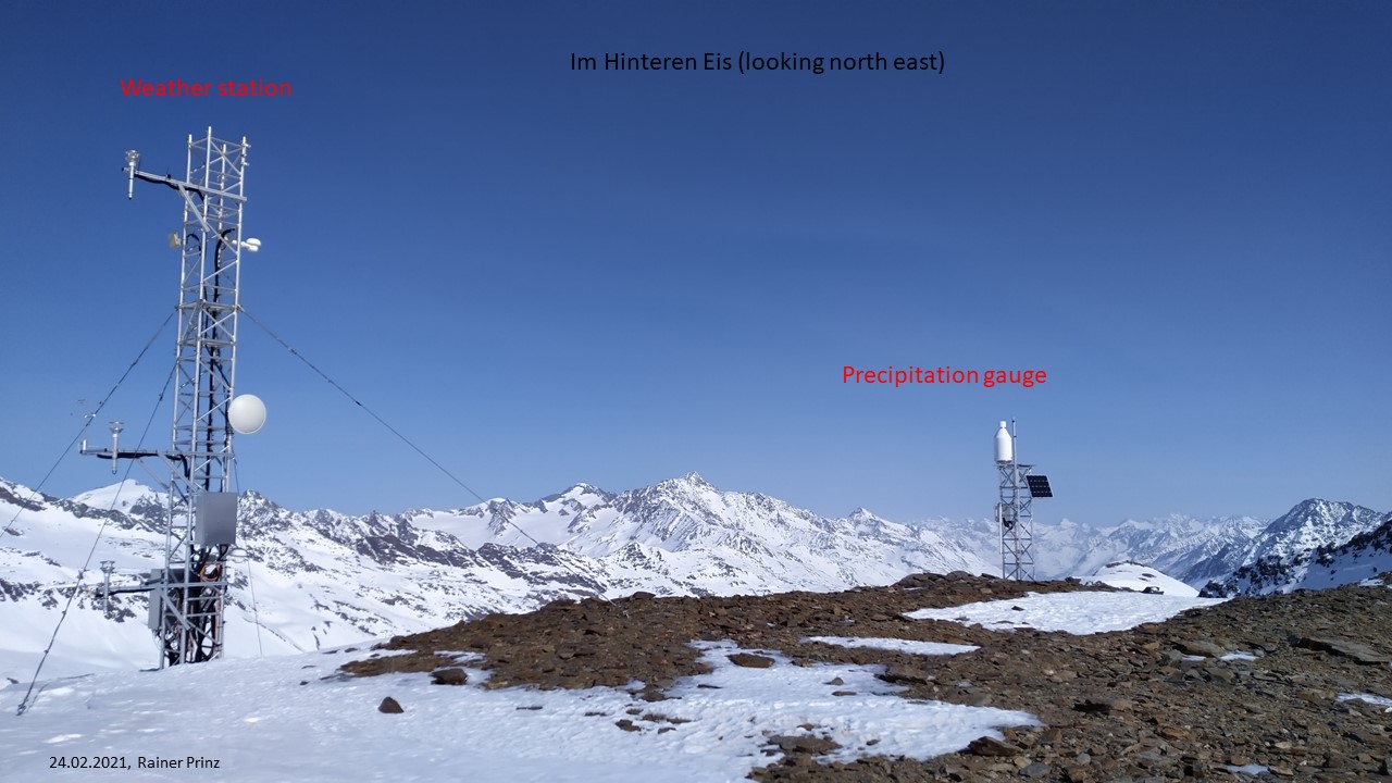
Figure 3: Mast and precipitation gauge.
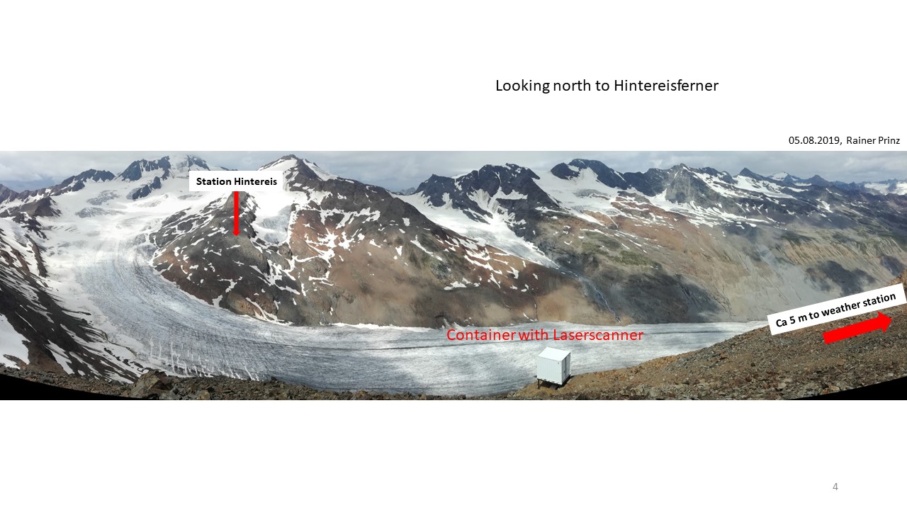
Figure 4: Site overview looking north to Hintereisferner.
Current Station Equipment
- Logger:
- Campbell Scientific CR3000
- Air Temperature and air humidity:
- Rotronic HC2-S3: Temp, RH permanently ventilated; 1.50 m and 5.50 m above ground. No.1 is lower sensor, No.2 is upper sensor.
- Radiation:
- Kipp&Zonen CNR4: four component radiation measurements LWin, LWout, SWin, SWout; 1.35 m above ground Radiation conversion factors (µV/W/m²) 26.08.2017 - 10.10.2025 08:00: LWin 11.77, LWout 13.33, SWin 12.19, SWout 13.69. Radiation conversion factors (µV/W/m²) 10.10.2025 08:00 - ?: LWin 12.78, LWout 12.04, SWin 12.27, SWout 12.00.
- Wind sensors:
- Lufft Ventus-UMB: 2D wind speed and direction; 1.50 m, 3.00 m and 6.00 m above ground. No.1 is lower sensor, No.2 is middle sensor, No.3 is upper sensor. Metek uSonic-3: 3D anemometer: 3.18 m above ground
- Pressure:
- Setra278 CS100: atmospheric air pressure
- Distance to surface (snow depth)
- Campbell Scientific SR50ATH-L; distance to snowfree ground: 1.12 m
- Solid particle flux (wind drifted snow):
- ISAW FlowCapt FC4: mounted on mast for precipitation gauge
- Preciptiation (separate mast):
- Geonor T200B on a CR310 datalogger
Station History
- 26th-31st August 2017: Installation of the station
- 30th August 2019: Installation of pluviometer
- 09th September 2020: Replaced upper T/RH sensor and vetialtion unit
- 10th July 2025: Relaced Ventus 1 and 2 (presumably broken in summer 2024) and both T/RH sensors including ventilation units
- 10th October 2025: Replaced CNR4 radiometer
Data Quality notes
- Quality issues with wind direction (before 01.05.2019) and ventilation of upper T/RH sensor (unknown when broken, repaired 09.09.2020).
- Check wind direction 3D anemometer. North = 70°.
- No wind speed and direction data stored in low frequency data files. High frequency data files available upon request.
- Snow depth data has limited meaning. Due to the extreme wind exposure the station site is snow free almost all winter.